
RUSH CREEK TRAIL TO AGNEW LAKE | JUNE LAKE, CALIFORNIA
If you’re looking for a modest morning workout, this trail is a great choice. The views are spectacular, and the climb is very manageable, with plenty of flat spots to catch your breath. We’re staying up near Mammoth Lakes on Forest Service land this weekend and found this hike via onX Baccountry during a drive around June Lake yesterday. It was our first time visiting June Lake, and when we saw Horsetail Falls, we knew we had to come back early the next morning and check it out for ourselves.
We arrived early at the trailhead—which we’d recommend due to the heat later in the day. Coming from the south on Highway 395, you’ll turn left at the sign for June Lake Junction. Follow June Lake Loop Road until you see Silver Lake on your right. You’ll loop around past Silver Lake Resort, and the trailhead will begin on your left, across the street from Silver Lake Campground. Parking is free.
I started my Garmin at the parking lot and logged 6.2 miles round-trip. This is an out-and-back trail. The AllTrails app said the hike would be 4.2 miles, but it was definitely longer to reach Agnew Lake. This could be due to where we started, though we followed the map pretty accurately and still logged extra mileage.
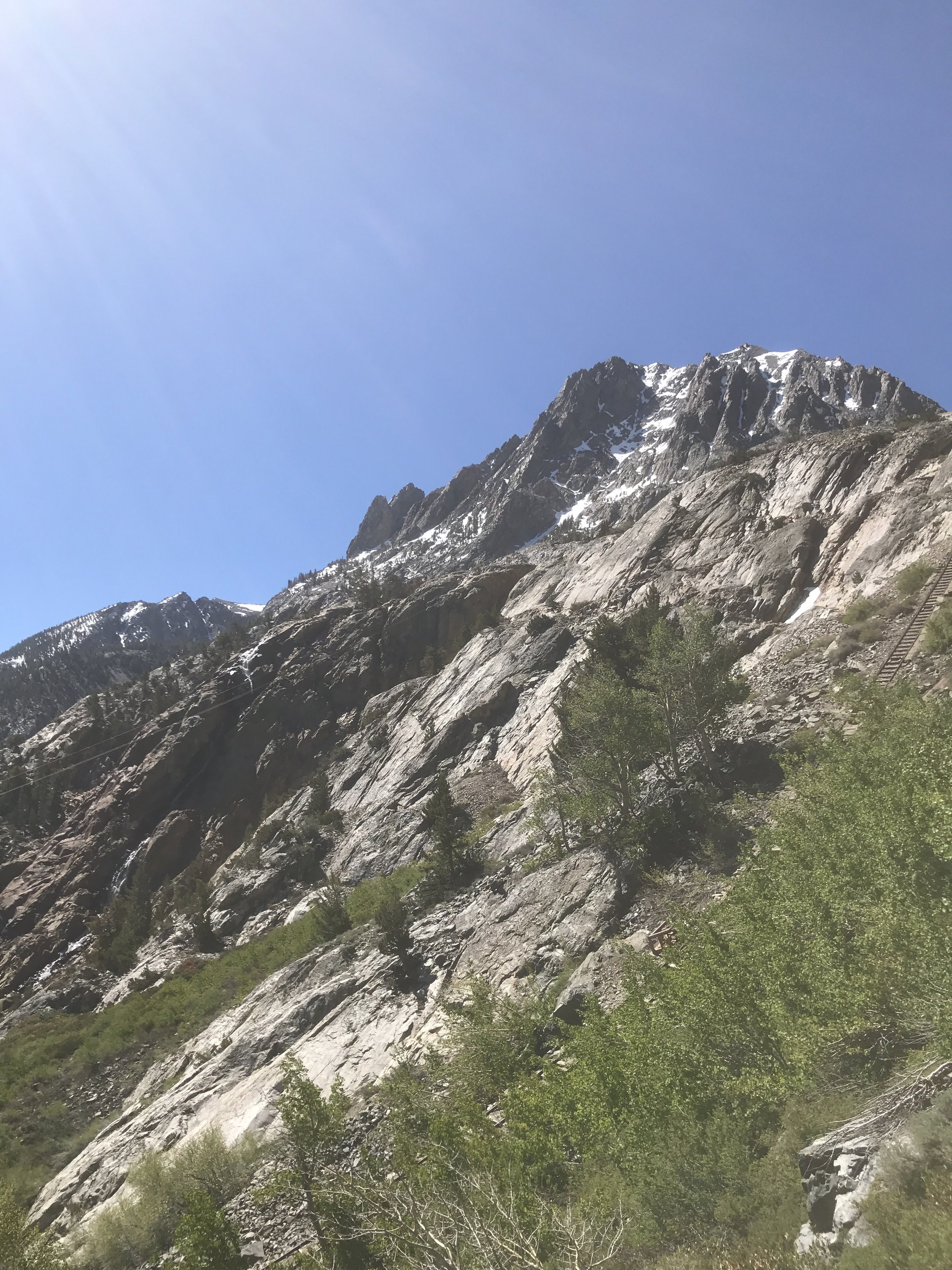
The hike begins (Google Maps labels it the Gem Lake Trail) with an easy walk through some shrubland, then quickly transitions to a grove of small aspens and a couple of creek crossings. You’ll soon begin ascending along the side of the mountain, with June Lake Loop Road visible below. The views are incredible, and there are a few places to stop and admire them—especially near the Bristlecone Pines clinging to the mountainside.
About three-quarters of the way up, you’ll cross over a cable car railroad, which was a neat surprise (wish I knew more about it!). After a few switchbacks, you’ll cross the tracks a couple more times. From these sections, you’ll catch some awesome views of Horsetail Falls, although there isn’t a trail that leads right up to them.
Make sure to soak up the scenery on the way up—because honestly, Agnew Lake wasn’t the most exciting destination. It was pretty low for this time of year, and there was a lot of leftover mining material scattered around. A sign marked “Agnew Lake Access,” but it only led us to a small stream flowing from the lake, with not much else to see.
We started hiking a bit further toward Gem Lake but ended our climb at a Bristlecone Pine tree with a sign that read:
“Agnew Lake – Elevation 8,508 – Inyo National Forest.”
We made this our turnaround point. The lake didn’t seem worth pushing on to. Instead, we had some trail mix and a beer in the shade—always a win—and then made our way back down.
The descent was easy, with a few chossy (loose rock) sections, but nothing sketchy. The views on the way down were just as beautiful as on the way up.
Final Thoughts:
I’d rate this hike to Agnew Lake a 3.5 out of 5.
The views along the trail are worth it, but Agnew Lake itself is a bit underwhelming.
Quick Takeaways:
Leave early – There’s minimal shade, and it gets warm by late morning.
Track your mileage – Our total distance was longer than what AllTrails listed.
Watch for pack trains – This trail is used to support hikers on the PCT/John Muir Trail.
Leave No Trace – Pack out your beer cans, snack wrappers, and whatever else you bring in.
(I rate my beer can crush an 8.4 – hell yeah.)
Happy hiking!